UNESCO World Heritage Trail – Bench No. 4: In the Shadow of the “Spitze Stei”
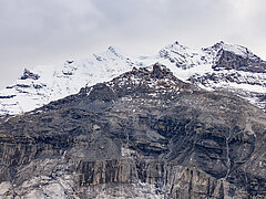
Since then, the area has been intensively monitored. GPS measurement stations record movements in the area around the clock. In the summer months, the area around the “Spitze Stei” moves by up to 10 centimetres per day. In some places, several metres per year are measured. A key influencing factor is the thawing of permafrost, which compromises slope stability.
Permafrost
Permafrost refers to ground that remains below 0°C all year round. Today, it is mainly found on north-facing slopes above 2,500 metres and still accounts for around 5% of Switzerland’s surface area.
Protective Measures
The data from the Spitze Stei are regularly analysed by specialists, who continuously assess the situation. Their situation reports are published at regular intervals. If necessary, measures such as temporary closures can be introduced. To protect infrastructure, preventive measures such as protective dams have also been built.
Further Links (in German)
– Animations on the Kandersteg website
– Documentary DOK “Crumbling Mountains – How Alpine Villages Defy Danger” (1:32:41)
– “Rockfalls in the Alps – How Climate Change Transforms Our Mountains”, ZDF planet, 29.10.23 (28:44)